Newsletter Photo Gallery
Do you have any interesting coastal photos to share? Send them to us by email at coastalcommission@igu-coast.org. We’ll feature them in future newsletters!
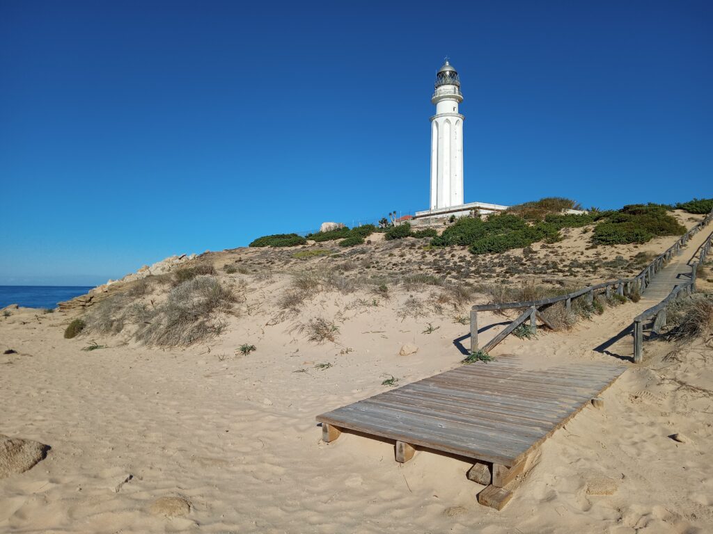
The Trafalgar Lighthouse, located on the southern coast of Spain in the province of Cádiz, stands as a beacon overlooking the Strait of Gibraltar and the Atlantic Ocean. This iconic structure not only serves as a navigational aid but also carries a rich history and offers panoramic views of the coastline.
Photo credit: Irene Delgado-Fernandez, University of Cádiz.
No. 90 – January 2024 Newsletter
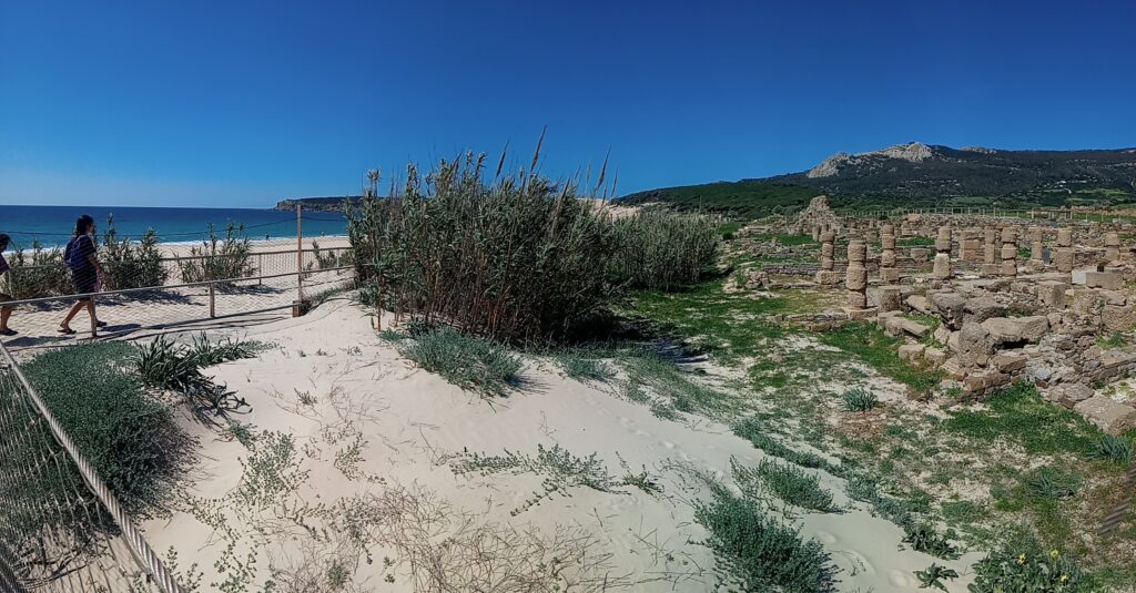
The sea meets the archaeological site of Baelo Claudia at the beach of Bolonia (Andalusia, Spain). The Romans settled at this location some 2,000 years ago and developed an industry based on tuna fishing, salt extraction, and the production of garum. Bolonia is also well known for the large mobile dune system on its western end and the strong winds attracting thousands of windsurfers to this section of the Cadiz coastline.
Photo credits: Irene Delgado-Fernandez, University of Cádiz.
No. 89 – July 2023 Newsletter
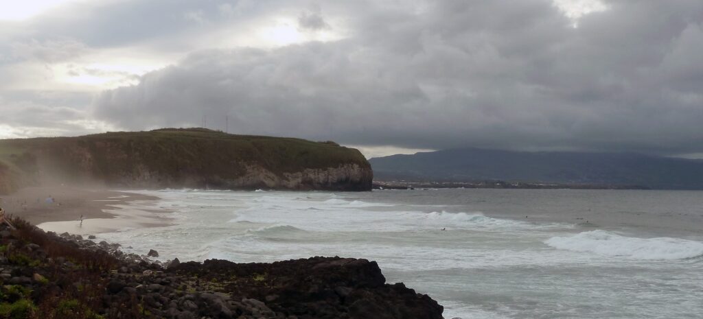
The beach of Santa Bárbara (Sao Miguel Island), located in the parish of Ribeira Seca, is one of the most extensive beaches in the Azores, Portugal, it is a kilometer in length. Santa Barbara is set on cliffs that fall from the mainland to the beach. It is well known internationally for its world-class waves that justify the annual holding of surfing and bodyboarding.
Photo credits: Margarita Stancheva, CCMS.
No. 88 – January 2023 Newsletter
In the Cyclades (central Aegean Sea, Greece) the morphological slopes are intense and the run-off distance from upstream to the coastline is short. This results in the loss of fresh water which also has not enough time to be absorbed and enrich aquifers. This area receives a little atmospheric precipitation most of which is distributed in a few events. It belongs to the most affected areas by the climate crisis and they are already facing desertification. During summer months, residents block the estuary so that they can use its water for irrigation purposes.
Photo credits: Niki Evelpidou, National & Kapodistrian University of Athens.
No. 87 – July 2022 Newsletter
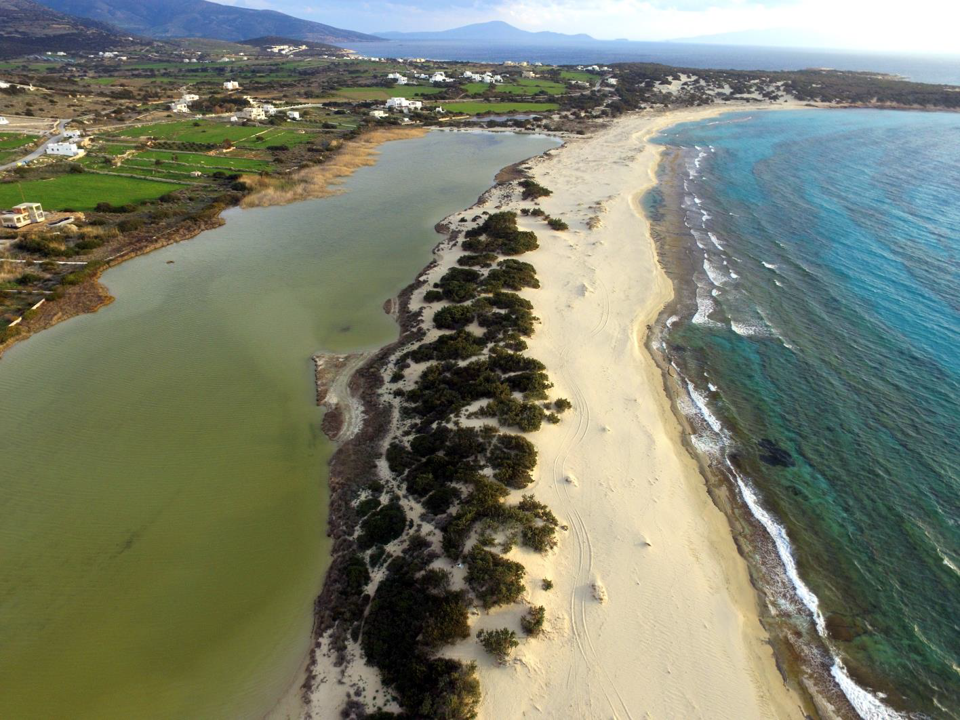
Several coastal and marine landforms testify to the late Holocene, the relative sea level changes, and the present-day evolution, providing evidence of the morphological configuration of the coastline and the coastal evolution of central Cyclades (Aegean Sea, Greece). This site is situated in the western part of Naxos Island, the biggest of Cyclades complex islands. The coastal zone of this site is composed of sandy beach, bordered by low-lying sand dunes. Dune fields are developed, at an almost continuous area of 20 km defining the back-shore boundary, relative to the coastline, while at the same time, natural coastal wetlands (lagoons) extend behind the dunes, inland, below sea level. The submarine area is characterized by the presence of a series of beachrock slabs identifying former fossilized beaches. Sand dunes are one of the most vulnerable and threatened ecosystems of the island which is facing ongoing desertification for many reasons.
Photo credits: Niki Evelpidou, National & Kapodistrian University of Athens.
No. 86 – January 2022 Newsletter