RESOURCES
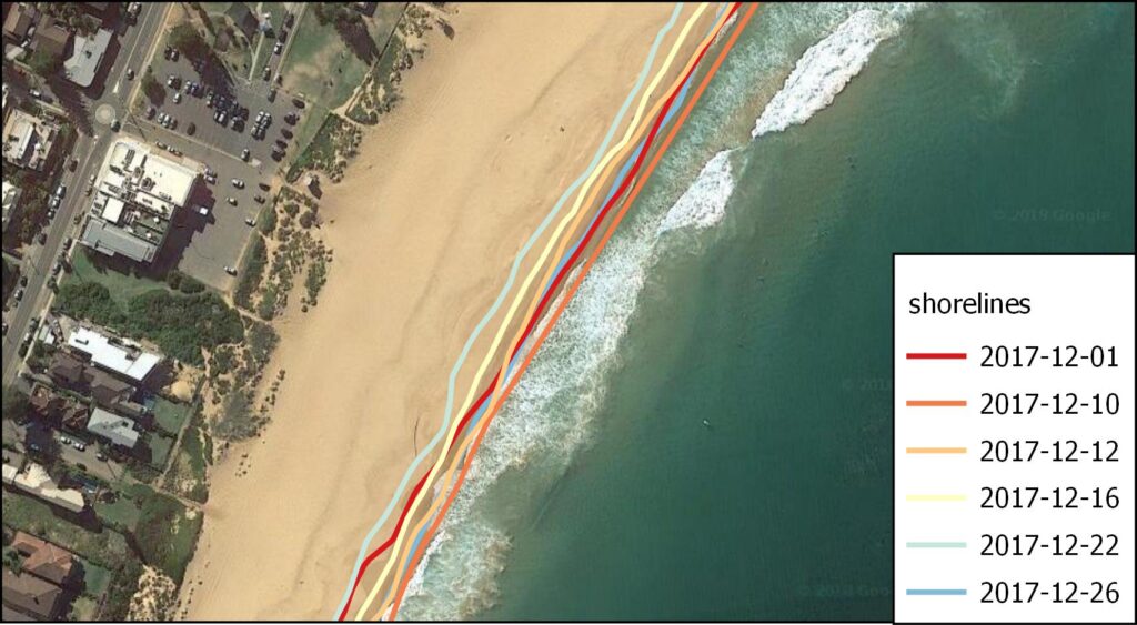
CoastSAT
CoastSat is an open-source software toolkit written in Python that enables users to obtain shoreline position at any coastline worldwide from 30+ years (and growing) of publicly available satellite imagery.
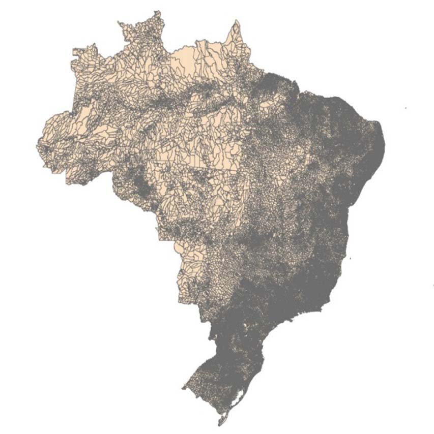
Global Intertidal Data
Understanding the distribution, trajectory and change of the world’s intertidal coastal ecosystems. Delivering the first global data on the distribution of tidal flats, among the world’s most widespread coastal ecosystems.
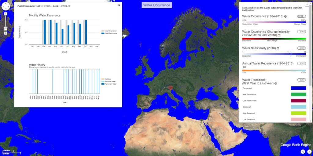
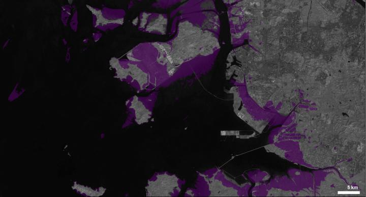
Global Surface Water
A virtual time machine that maps the location and temporal distribution of water surfaces at the global scale over the past 3.6 decades and provides statistics on their extent and change to support better-informed water-management decision-making.
Coastal sea level anomalies
This new coastal sea level product has been further analysed to compute sea level trends over the 17-year time span along each track 20-hz point, from 20 km offshore to the coast. A severe selection has been carried out on all coastal portions of the satellite tracks crossing land, leading to retain a set of 429 coastal sites of valid sea level time series and trend values.
WorldPop
WorldPop develops peer-reviewed research and methods for the construction of open and high-resolution geospatial data on population distribution, demographics and dynamics, with a focus on low and middle income countries.
Future Earth Coasts
Future Earth Coasts is a Global Research Network of Future Earth, a platform for translating sustainability knowledge into action that includes a number of United Nations agencies, intergovernmental bodies and organisations such as the International Council for Science.
Future Earth Coasts acknowledge and pay our respects to the Traditional Owners and the Elders past, present, and emerging throughout the world’s coastal zones, who hold the memories, traditions, cultures, and hopes of Indigenous People around the world.
CoastalDEM
CoastalDEM is Climate Central’s proprietary, high-accuracy Digital Elevation Model (DEM) for coastal areas. It reduces median errors in NASA’s widely-used SRTM DEM to near zero, and reveals flood threats more than three times larger. Top-accuracy DEMs from airborne LiDAR are unavailable for most of Asia, Africa and Latin America. CoastalDEM can help you understand coastal risk in these areas and globally.
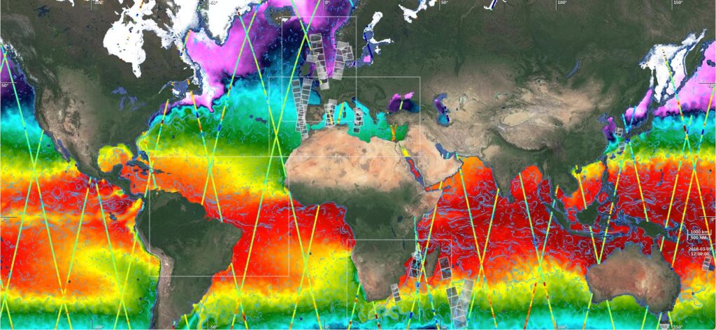
Ocean Virtual Laboratory
The Ocean Virtual Laboratory is funded by the European Space Agency under the SEOM program. The main objective of the project is to develop a virtual platform to allow oceanographers to discover the existence and then to handle jointly, in a convenient, flexible and intuitive way, the various co-located EO datasets and related model/in-situ datasets over dedicated regions of interest with a different multifaceted point of view. This is first demonstrated over the Agulhas region.
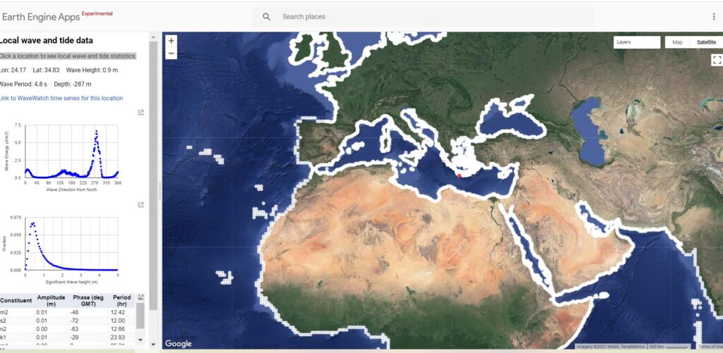
Local Wave and Tide Data
Click a location to see local wave and tide statistics.
Marine Data Portal
The ADMIRALTY Marine Data Portal provides access to view and download marine datasets held by the UK Hydrographic Office (UKHO).
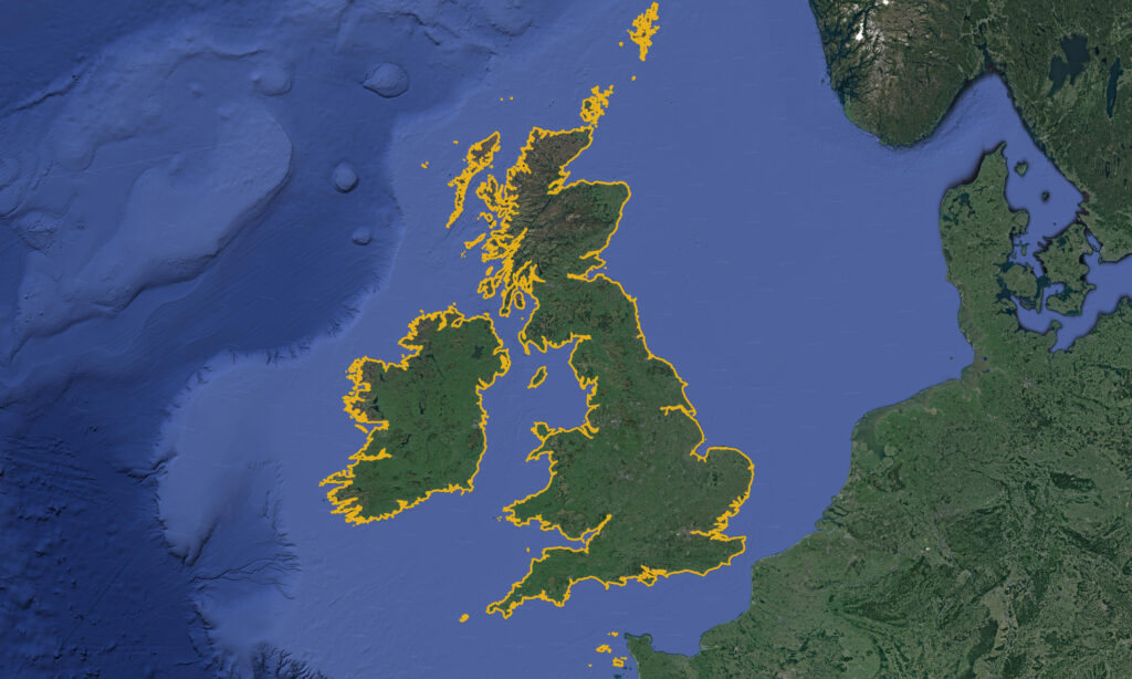
World Vector Shoreline (WVS)
The original World Vector Shoreline (WVS) was a digital data file containing the shorelines, international boundaries, and country names of the world. WVS data were processed into NGA’s Vector Product Format in the highest resolution demarcation of coastline globally available, the World Vector Shoreline Plus.
Spatial Data Management with Google Earth Engine
In this course, you will learn how to retrieve, analyse and manage spatial using Google Earth Engine (GEE) and the GEEmap Python package. GEE is a free cloud computing platform with over 35 petabytes of satellite imagery, geospatial imagery, and geospatial datasets. The GEEmap Python package enables users to analyse and visualise Earth Engine datasets interactively within a Jupyter-based environment. Upon completion of this course, you will be able to utilise the multi-petabyte Earth Engine Data Catalog for large-scale geospatial analysis.
Coasts for Kids the Series
The series is a collaborative experience between kids and their families, coastal scientists, teachers, community artists, coastal managers, and illustrators.
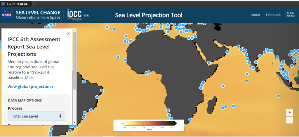
Sea Level Projection Tool
Median projections of global and regional sea level rise, relative to a 1995-2014 baseline.
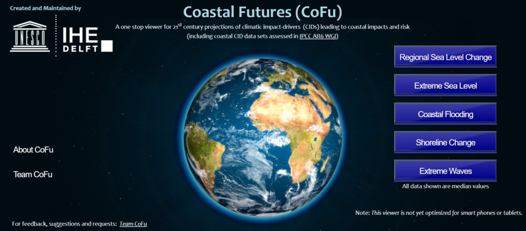
Coastal Futures (CoFu)
A one-stop viewer for 21st-century projections of climatic impact drivers (CIDs) leading to coastal impacts and risk (including coastal CID data sets assessed in IPCC AR6 WGI).
Coastal Education and Research Foundation
The Coastal Education and Research Foundation (CERF) is the official publisher of the Journal of Coastal Research (JCR) and a nonprofit scientific society dedicated to the advancement of the coastal sciences and devoted to the multi-disciplinary study of complex problems within and around the coastal zone.
Living Deltas Research Hub
Sustainable delta futures in South and South-East Asia.
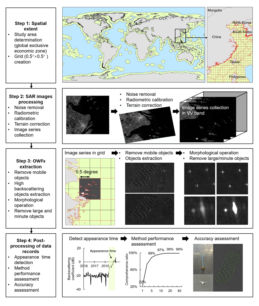
Global Offshore Wind Turbine Dataset
The location dataset consists of geocoded information on global offshore wind turbines (OWTs) derived from Sentinel-1 synthetic aperture radar (SAR) time-series from 2015 to 2019.
Digital Coast
The Digital Coast was developed to meet the unique needs of the coastal management community. The website provides not only coastal data but also the tools, training, and information needed to make these data truly useful. Content comes from many sources, all of which are vetted by NOAA.
Coast2Coast Zoominars
The Coast2Coast zoominar series started during the May 2020 Covid-19 lockdown to facilitate networking and interactions between researchers in a year when conferences and travelling were not going to happen. The Coast2Coast has quickly grown to become a prestigious seminar series with presenters from many parts of the world. Giovanni Coco (University of Auckland), Kristen Splinter and Mitch Harley (University of New South Wales), Ana Vila-Concejo (University of Sydney) and Ryan Lowe (University of Western Australia) are the hosts of Coast2Coast … at least for now!
Coast2Cast Podcasts
The Coast2Cast series is a series of interviews conducted by Giovanni Coco (University of Auckland) and Ana Vila-Concejo (University of Sydney) since 2021. The series covers interviews with researchers from many different backgrounds around the globe. The links to podcasts can be found on Spotify, Google Podcasts and Podbean
Source-to-Sink
Source to sink webinar series sponsored by NSF, co-sponsored & co-hosted by LSU, NCSU, SKLEC, Utrecht.
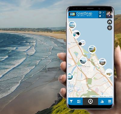
CoastSnap
CoastSnap is a global citizen science project to capture our changing coastlines..
Women in Coastal Geoscience and Engineering network
The Women in Coastal Geoscience and Engineering network (WICGE) aims to inspire, support and celebrate women in Coastal Geoscience and Engineering, at all stages of their careers, through networking, mentoring, and pushing for equal representation and opportunities. The network formed in 2016 and includes members all over the world. It facilitates links across age groups and career levels, in academia, government and industry.